 The Amazon and the Eastern Plains Region
GUAINIA
Inhabitant: Guainarense
The Amazon and the Eastern Plains Region
GUAINIA
Inhabitant: Guainarense
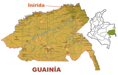
This department lies in eastern Colombia and covers an area of 72,238 square kilometers. It borders the department of Vichada in the northwest, Guviare and Vaupés in the west, the Republic of Venezuela in the east and the Republic of Brazil in the south.
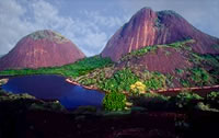
The land is formed by huge plains, some hills, the mountain range of Naquén and some rainforest regions. Inside the territory are the natural national park of Puinawai, the lake Matevení, the hills of Manicure and the Hills of Mavecuri, one of the most beautiful places in the country.
In the
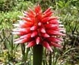
guainarense soil grows the beautiful flower of Inírida, which changes colours and shades throughout the year. This flower is considered one of the symbols of Guainía. The department has several rivers with a large flow.
Rivers play an important roll in the department, the Inírida being the most important one. It crosses the department diagonally to the northeastern and flows into the Guaviare, another very important river that marks the border with Vichada.
The average temperature of the region is 27 degrees Celsius and it has an average annual rainfall of about 3,000 millimeters (110 inches).
Guainía became an official department in 1991 and has approximately 42,000 inhabitants. The great majority of them are natives from the linguistic family of the Guahibo and Arawak tribes.
Guainía is the less densely populated department in Colombia, as there are only 0.17 inhabitants per square kilometer.
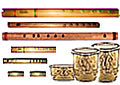
The department's economy is based on fishing, hunting, livestock, lumber and fibre extraction from the Chiquichiqu palm and the
yaré reed, used for handicrafts. According to historians, the yucca root was first found in Guainía. Later on, it was spread all over Colombia.
A few years ago, important gold and diamond mines were discovered near the borders with Venezuela and Brazil.
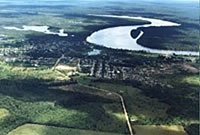
Capital: Inirida
Inírida was created in 1965 by settlers that arrived in the region.
It has been a municipality (the only one in Guainía) since 1974 and has about 23,000 inhabitants.
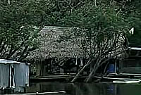
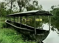
This picturesque city is situated on the banks of the Inírida River and very near the Guaviare River. It is an important port and the commercial center of the entire department.